New Cal Fire maps show increased wildfire risk in Redlands; Fire Department says it was ready
New Cal Fire map shows increased risk in North Redlands and critical infrastructure sites, but officials say proactive work has been underway for years.
New Cal Fire map shows increased risk in North Redlands and critical infrastructure sites, but officials say proactive work has been underway for years.

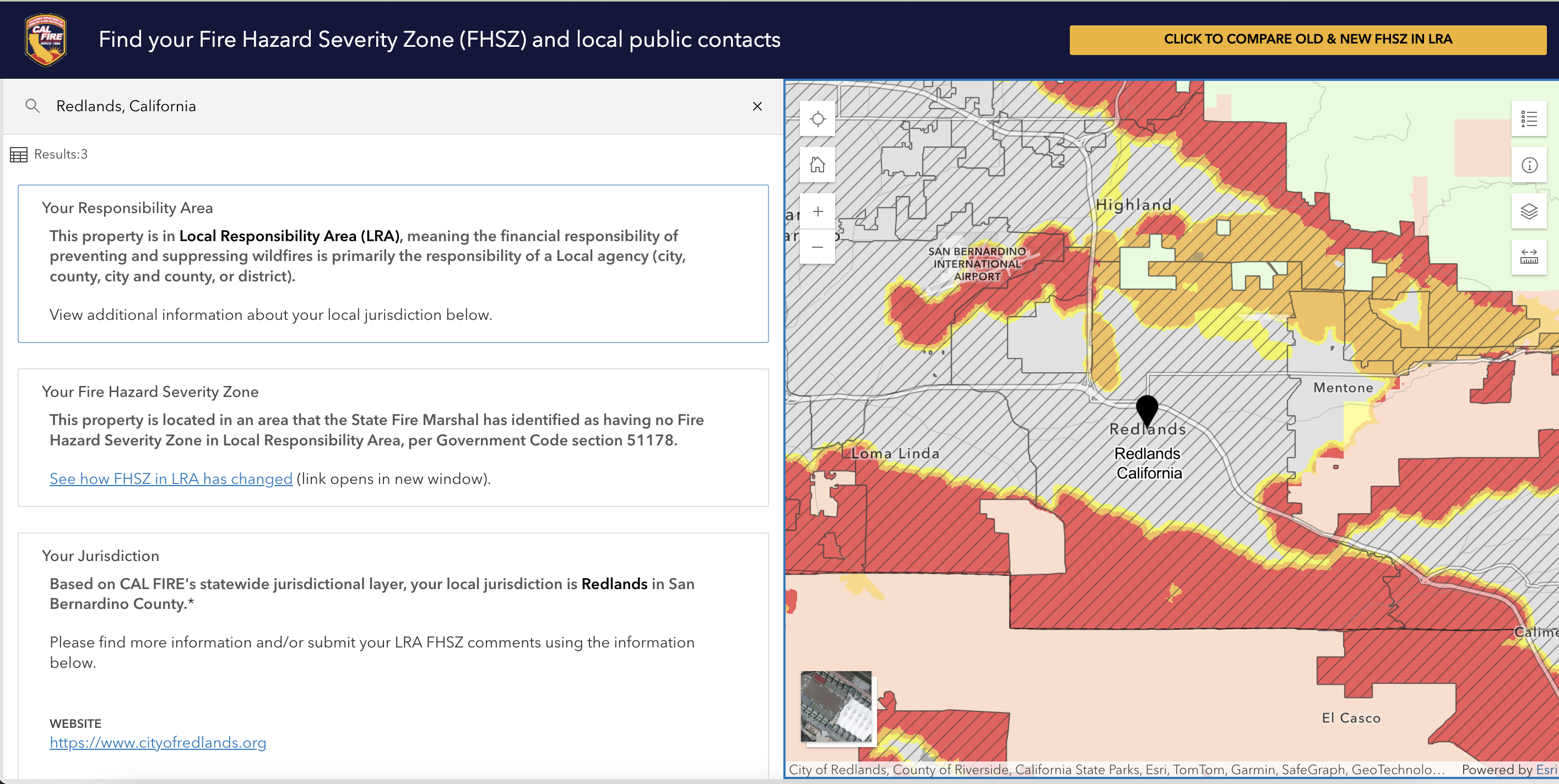
REDLANDS, Calif. — A new wildfire hazard map released by the California Department of Forestry and Fire Protection (Cal Fire) this month shows expanded risk zones across Redlands, including areas of North Redlands now classified as “Moderate” to “Very-High” fire hazard.
The March 24, 2025, update marks the first time since 2007 that Cal Fire has revised the Fire Hazard Severity Zone (FHSZ) maps for Southern California.
The maps classify land based on the likelihood and expected fire behavior over a 30- to 50-year period. The new map uses a scientific model that considers fuel sources, wind, slope, historical fire behavior and terrain. While the maps are not intended to reflect current fire “risk”—which would account for home hardening or fuel mitigation—they provide a long-term view of the physical conditions that make wildfire more likely.
Southern and eastern Redlands, including San Timoteo Canyon, Live Oak Canyon and the Crafton Hills area, remain in the “Very High” fire hazard category.
The updated maps now include the east side of Interstate 210 and large areas in far north Redlands with "moderate" and "high" fire hazard risk.
But Redlands Fire Chief Rich Sessler said the city has long anticipated these changes—and has already been working in the affected areas.
“We weren’t caught off guard,” Sessler said in a phone interview with Community Forward Redlands on April 1. “We were expecting some increases in those areas—it wasn’t a big surprise to us as a department.”
One of the more significant changes in the updated map is the inclusion of Redlands’ wastewater treatment facility at 1950 Nevada St. in a “Very-High” fire hazard zone. Sessler confirmed the city has been proactively managing vegetation and fuel loads around the site for several years.
“We’ve been working with the California Conservation Corps, and they’ve been clearing vegetation around the water treatment plant since last year,” he said. “We’re also coordinating with Cal Fire crews to do more work around that facility in the next few months.”
The city also has a wildfire protection agreement with Cal Fire that covers nearly 6,000 acres in Redlands, allowing for additional response resources during fire events in high-risk zones.
The updated Cal Fire map has not yet been incorporated into Redlands’ Community Wildfire Protection Plan (CWPP), which the city adopted in early March. The plan was years in the making and was finalized just weeks before the state released its updated hazard designations.
The CWPP focuses largely on known fire-prone areas along the city’s edges—such as Smiley Heights, the canyons south of Interstate 10, and undeveloped parcels near Mentone. It outlines goals including interagency coordination, fuel reduction, emergency notifications and public education.
The plan also identifies fuel reduction projects in high-risk corridors like Sunset Drive, Alessandro Road and Live Oak Canyon, as well as vegetation management near critical water infrastructure and public rights-of-way.
But Sessler emphasized the CWPP is a “living document” that can be updated once the new state maps are formally adopted by the Redlands City Council later this year.
“It just lines up well that we can show all the proactive work we’ve already been doing,” Sessler said. “The timing is good. We’re ready to make adjustments and revisit areas as needed.”
He added that areas along the 210 Freeway flagged in the new map are largely vacant parcels that the department has been abating annually—long before the new hazard designations were announced.
The new fire hazard designations come as homeowners in California are already facing a spike in insurance costs.
For residents concerned about rising insurance premiums, Sessler said the CWPP and other local wildfire prevention programs can be valuable tools during insurance negotiations.
“We’re doing everything we can as a local government to give our homeowners the best chance they’ve got,” he said. “Having an adopted CWPP, weed abatement, home hardening information, and now wildfire cameras—all of these are things insurance companies are asking about.”
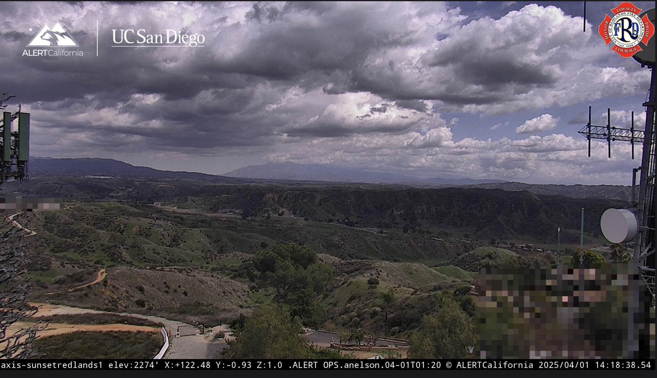
Sessler was referring to Alert California wildfire cameras recently installed in San Timoteo Canyon. The state-of-the-art cameras, launched in November, allow Redlands fire personnel and dispatchers to monitor real-time activity using infrared technology and receive alerts when heat or fire is detected.

Notifications are sent directly to the fire chief and dispatch phones or emails within seconds, which allows fire personnel to see exactly what's happening and increase response time.
Residents who have any questions about the new fire maps or home owner insurance should "feel free to reach out," Sessler said.
Residents interested in exploring the newly designated zones in North Redlands can visit the fire department’s website and use the interactive map to look up their address.

The maps are currently open for public comment through April 30. If you would like to submit public comment related to the adoption of the fire hazard severity zones in Redlands, residents can e-mail fireprevention@cityofredlands.org.
The department is hosting its second Community Chipper Day on April 26 at Kimberly Elementary School, where residents can drop off brush and yard waste for free. A second event is being planned for later this summer in another part of the city.
“This is our most proactive year yet,” Sessler said. “We’ve had some real wins in getting large vacant parcels abated—things that haven’t been done in years.”
More information about Redlands Community Wildfire Safety & Statewide Fire Hazard Zone Map Updates here.
Redlands Fire Department Community Risk Reduction: 909-798-7601
Sign up for our weekly newsletter