Redlands Mall demolition set; warehouse plan halted
Redlands News Weekly | March 12, 2026
City of Redlands announces storm preparedness efforts, including free sandbags

UPDATE 2/2/24 - An atmospheric river is expected to pass over Southern California early next week, according to the National Weather Service. Forecasters predict heavy rainfall and localized flooding from Sunday afternoon to Tuesday afternoon.
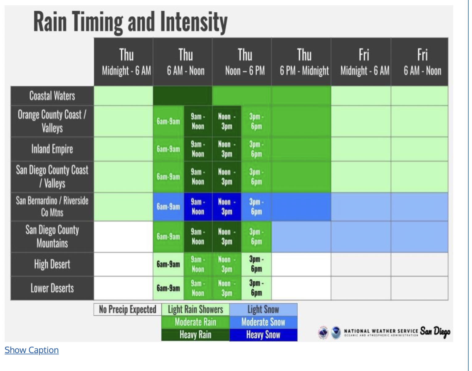
UPDATED 01/31/24 — Flood watch is in effect in San Bernardino County until 10am on Feb. 2, according to the National Weather Service. Flooding caused by "excessive rainfall" is possible beginning Thursday morning through the afternoon. Updated forecasts predict 1 - 1.5 inches of rain near Redlands Thursday thru Friday.

REDLANDS, Calif. – Following a stretch of warm, sunny days, Redlands is bracing for a shift as the National Weather Service predicts the return of cold and wet conditions starting midweek.
In the forecast: An atmospheric river is expected to drench Northern California before bringing heavy rain, wind, and snowfall to Southern California by Wednesday night. Forecasts from the National Weather Service San Diego predict rainfall between 1.5-2 inches from Thursday morning through Friday night near Redlands.
A second weather system is anticipated to bring additional precipitation early next week, prompting local authorities to issue advisories and reminders for preparedness.
Ways to prepare: The city's Emergency Operations Division is reminding residents to be aware of possible flooding. The city has a limited number of sandbags available to residents and local businesses at no cost.
While the city works to mitigate flooding through storm drain system maintenance and tree trimming, significant rainfall can overwhelm the city's flood control system. Residents should watch for localized flooding on city streets and in the Zanja and San Timoteo Canyon areas.
"Never drive through flooded roadways. If you come to an area that is covered with flood water, you will not know the depth of the water or the condition of the ground under the water. Road beds may be washed out under flood waters," Redlands Emergency Operations Division warned in a statement released Monday.
It does not take much to lose control on a flooded roadway, according to the National Weather Service's Turn Around, Don't Drown campaign. Just six inches of water will reach the bottom of most passenger cars causing a loss of control and possible stalling. A foot of water will float most vehicles off the roadway. Two feet of rushing water can carry away most vehicles, including SUVs and pick-ups.
Residents are also encouraged to take precautions to protect private property, including:
Non-emergency flood-related issues should be reported to the Facilities and Community Services Department at (909) 798-7655. For any emergency situation call 911.
Additional information is available at the city's Emergency Management page to help residents prepare for heavy rain and potential flood conditions.
This is a developing story.
Sign up for our weekly newsletter